Johor Bahru LRT and Commuter Fantasy Map
This is not an official map. This map is an unofficial proposal for an LRT and KTM Komuter system for Johor Bahru and surrounding areas.
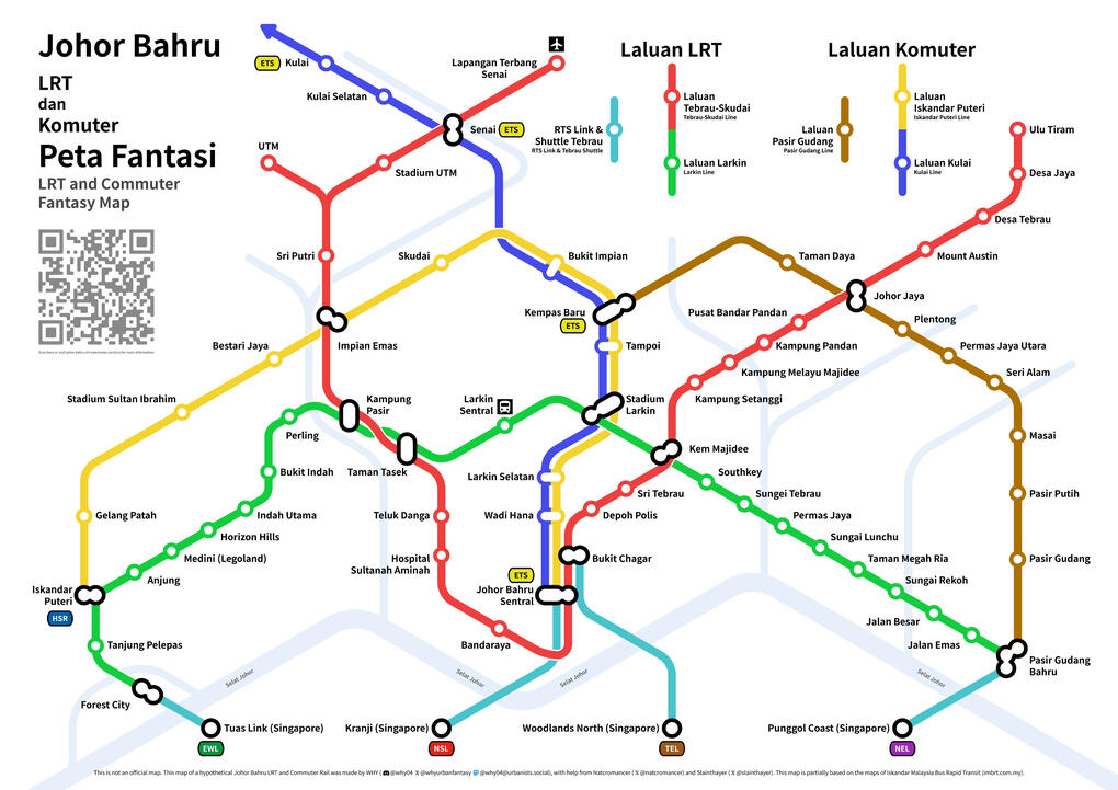
The map was made using Inkscape, and features a diagram of all the LRT and KTM Komuter lines in the city and surrounding region, as well as the RTS Links connecting to neighbouring Singapore across the Johor Straits.
Train frequencies are as follows:
| Line | Peak-hour Frequency | Off-peak Frequency |
|---|---|---|
| LRT Tebrau-Skudai Line (Main Line) | 2.5 minutes | 5 minutes |
| LRT Tebrau-Skudai Line (UTM Branch) | 5 minutes | 10 minutes |
| LRT Tebrau-Skudai Line (Senai Airport Branch) | 5 minutes | 10 minutes |
| LRT Larkin Line | 5 minutes | 10 minutes |
| KTM Kulai Line | 15 minutes | 30-45 minutes |
| KTM Iskandar Puteri Line | 15 minutes | 30-45 minutes |
| KTM Pasir Gudang Line | 15 minutes | 30-60 minutes |
| KTM Shuttle Tebrau | 5 minutes | 15 minutes |
| RTS Link 1 (Bukit Chagar-Woodlands North) | 2.5 minutes | 5 minutes |
| RTS Link 2 (Forest City-Tuas Link) | 5 minutes | 10 minutes |
| RTS Link 3 (Pasir Gudang Bahru-Punggol Coast) | 2.5 minutes | 10 minutes |
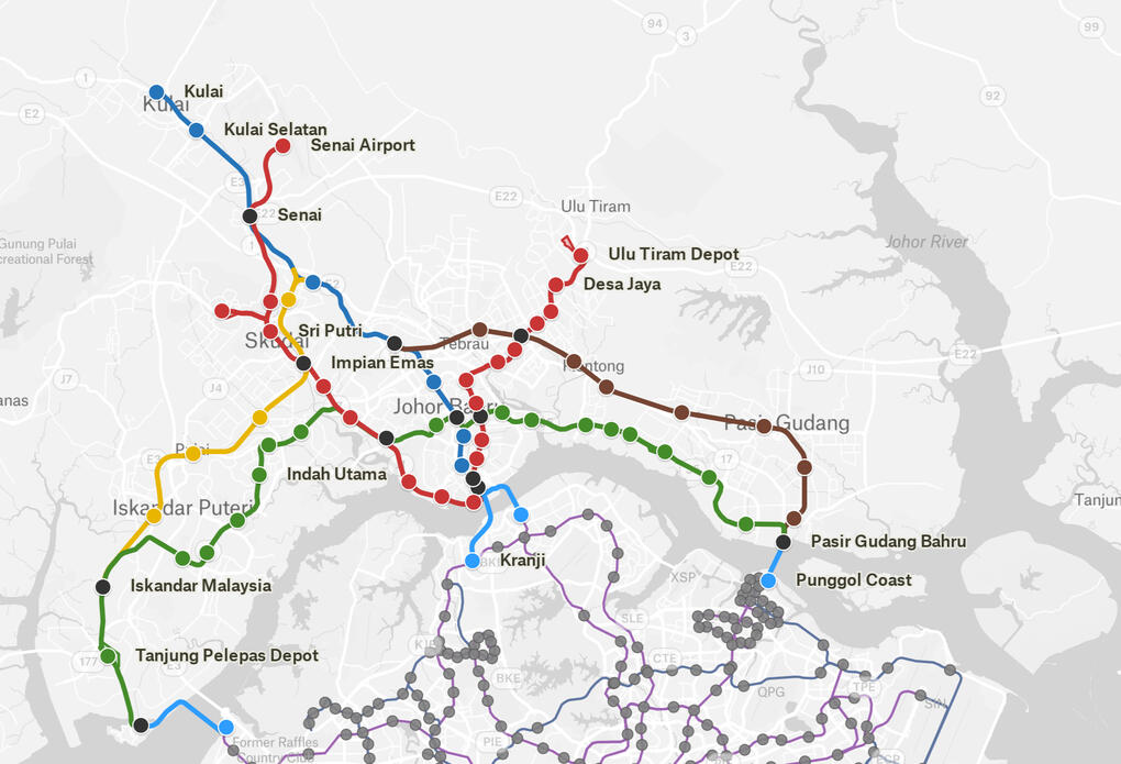
This map was made with Felt, and showcases a zoomed-out geographic view of the entire route, including connections to Singapore's MRT and LRT (click to view the interactive version).
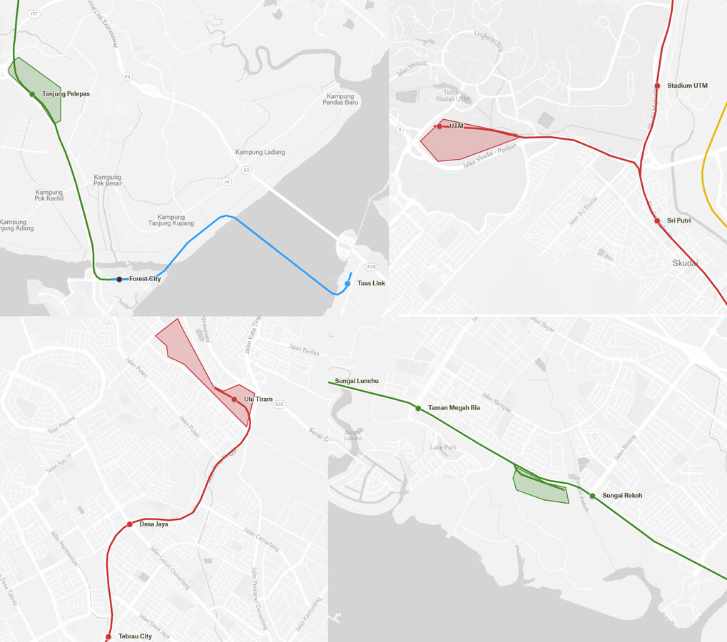
Depots could be located at or near the ends of both lines, enabling trains to be put into service quickly at the start of each day and taken out of service at the end of the day. These depots could also support housing projects built above the depot, similar to depots in Hong Kong, Tokyo and Seoul. In addition, Tanjung Pelepas depot could also house trains for an RTS Link between Forest City and Tuas.
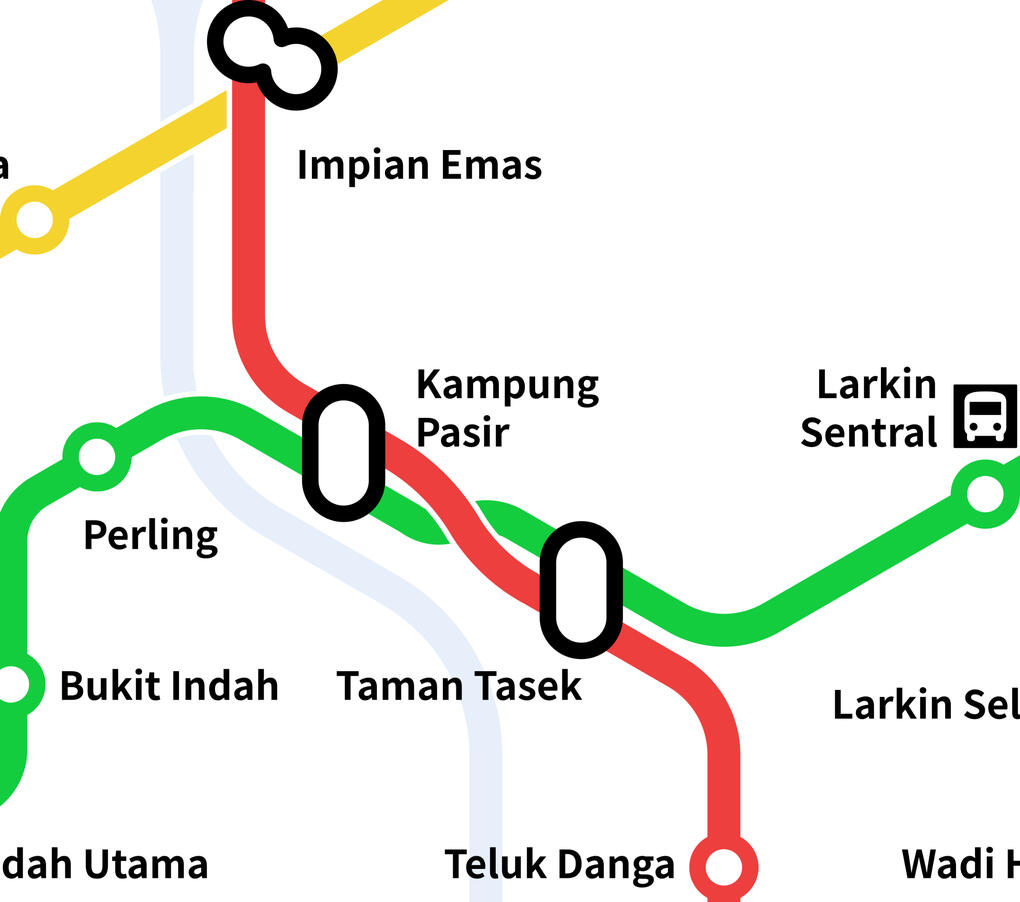
On the LRT lines, Kampung Pasir and Taman Tasek are paired cross-platform interchanges, similar to City Hall and Raffles Place in Singapore. Passengers traveling in the same direction can cross the platform at Kampung Pasir, while passengers traveling in the opposite direction can cross the platform at Taman Tasek or take the escalator between the platforms at Kampung Pasir.
For KTM Komuter, new stations would have to be constructed, and the Tanjung Pelepas and Pasir Gudang branch lines would have to be double-tracked and electrified. The Tanjung Pelepas line was constructed with provisions for double track and electrification, while the Pasir Gudang line would take longer as it does not have such provisions.
Rolling stock is not particularly important— as the LRT system is completely at ground level or elevated, light metro and monorail trains would be most suitable for automated operations similar to the LRT in Kuala Lumpur.
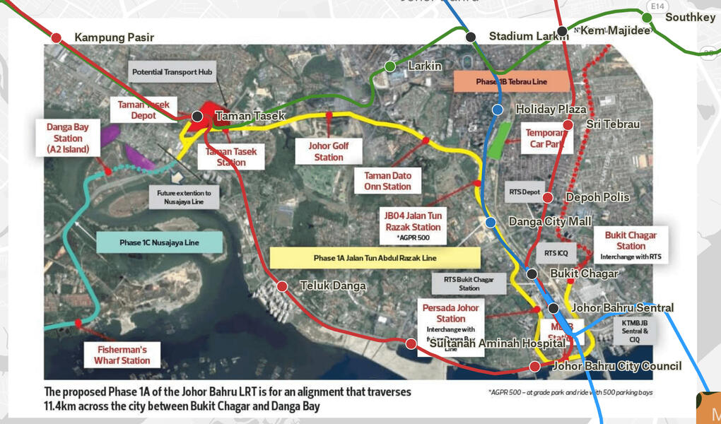
Above is a comparison with the Nylex consortium's proposed map for JB LRT (source). A major area where my map differs is the de-interlining of the major corridors into 2 separate LRT lines, allowing for independent operations at high frequency as well as crosstown journeys and connecting to Larkin bus terminal.
This map and website were created by WHY.Contact me here:
Discord tag: @why04
𝕏 tag: @whyurbanfantasy
Mastodon tag: @[email protected]Many thanks to @slainthayer and @natcromancer for their help on this map!
